Date of Formation: Latehar District was carved out of Palamu District on 4th April 2001
Area: 3630 square kilometers
Density of Population: 200 people per square kilometer
Literacy Rate: 61.23 % - Male: 71.80 %, Female: 50.26 %
Male Female Ratio: 1000:964
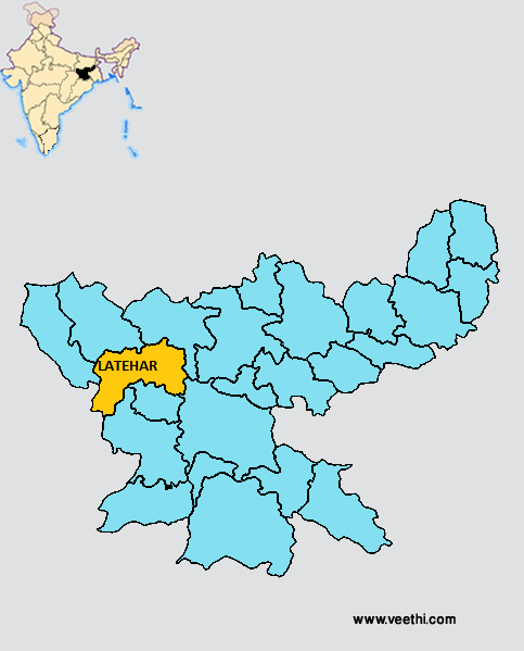
Boundaries of Latehar District
North: Palamu District, Jharkhand
North East: Chatra District, Jharkhand
North West: Garhwa District, Jharkhand
South: Lohardaga District, Jharkhand
South East: Ranchi District, Jharkhand
South West: Gumla District, Jharkhand
Latehar District Average Rainfall: 905 mm
Latehar District Average Temperature in Summer: 31 deg C
Latehar District Average Temperature in Winter: 15 deg C
LATEHAR DISTRICT MAP
Major Rivers: Barakar, Poanchkhara, Keso, Akto, Gurio, Gukhana, Nadi, Sakri
Blocks: Latehar, Barwadih, Garua, Mahuadanr, Chandwa, Balumath, Manika
Assembly Constituencies: Latehar, Manika
Latehar District Nearby Attractions
1. Betla National Park
2. Kanti Waterfalls
3. Lower Ghaghri Waterfalls
4. Sahi Falls
5. Lodh Waterfalls
6. Mirchaiya Waterfalls
7. Upper Ghaghri Waterfalls
8. Saint Paramhans Baba Tomb
9. Makamaro Hills
10. Shaktipeeth Maa Chanchala Devi
Latehar District Facts: This is one of the 21 most backward districts of Jharkhand that is receiving funds from the Backward Regions Grant Fund Program.
Major Agricultural Products: Paddy, maize, cereals, wheat, oilseeds
Major Industrial Products: Baskets, lac, forestry
Mineral Resources: Coal, bauxite, laterite, dolomite, graphite, quartz, fireclay, felspar
What is Latehar District Famous For: Adventure Tourism
Last Updated : Monday Jun 11 , 2012
.jpeg "Krishna Bharadwaj (actor)")


