Date of Formation: Narayanpur District was carved out Baster District on 11th May 2007.
Area: 7010 square kilometers
Density of Population: 20 people per square kilometer
Literacy Rate: 49.59 % - Male: 58.97 %, Female: 40.22 %
Male Female Ratio: 1000:998
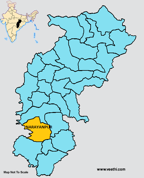
Boundaries of Narayanpur District
North: Kanker District, Chhattisgarh
South: Bijapur District and Dantewada District, Chhattisgarh
East: Bastar District, Chhattisgarh
West: Maharashtra
Narayanpur District Average Rainfall: 1324 mm
Narayanpur District Average Temperature in Summer: 33 deg C
Narayanpur District Average Temperature in Winter: 20 deg C
NARAYANPUR DISTRICT MAP
Major Rivers: Mahanadi
Blocks: Narayanpur, Padamkot
Assembly Constituencies: Narayanpur
Narayanpur District Nearby Attractions
1. Rajpuri Waterfalls
2. Shiva Temple at the banks of River Mahanadi
Narayanpur District Facts: The largest Catholic Church in Asia, Mahagirja Ghar is situated here. This is the least populous district of Chhattisgarh as of 2011.
Last Updated : Thursday Jun 14 , 2012


