Date of Formation: Rudraprayag District was carved out of Chamoli District, Tehri District and Pauri District on 16th September 1997.
Area: 1896 square kilometers
Density of Population: 119 people per square kilometer
Literacy Rate: 82.09 % - Male: 94.97 %, Female: 70.94 %
Male Female Ratio: 1000:1120
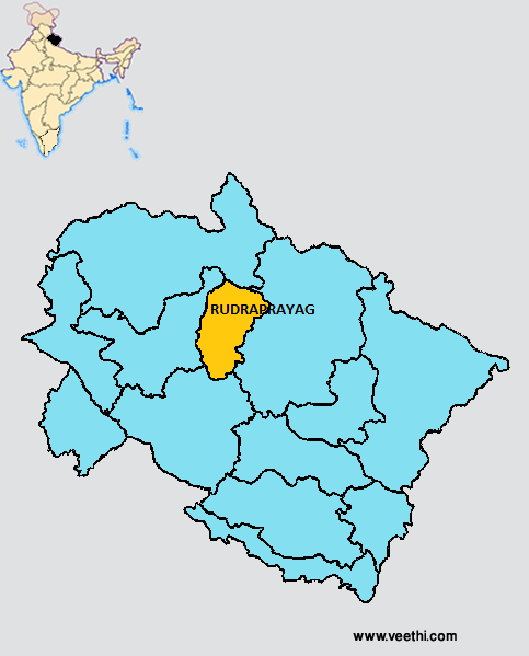
Boundaries of Rudraprayag District
North: Uttarkashi District, Uttarakhand
South: Pauri Garhwal District, Uttarakhand
East: Chamoli District, Uttarakhand
West: Tehri Garhwal District, Uttarakhand
Rudraprayag District Average Rainfall: 978.5 mm
Rudraprayag District Average Temperature in Summer: 23.39 deg C
Rudraprayag District Average Temperature in Winter: 8.66 deg C
RUDRAPRAYAG DISTRICT MAP
Major Rivers: River Mandakini, River Alaknanda
Blocks: Augustmuni, Jakholi, Ukhimath
Assembly Constituencies: Kedarnath, Rudraprayag
Rudraprayag District Nearby Attractions
1. Rudraprayag
2. Augustmuni
3. Guptkashi
4. Jakholi
5. Sonprayag
6. Khirsu
7. Gaurikund
8. Deoria Tal
9. Chopta
10. Ukhimath
11. Gandhi Sarovar
12. Vasuki Tal
13. Kedarnath Temple
14. Tungnath Temple
15. Omkareshwar Temple
Rudraprayag District Facts: It was noted for the man eating leopard that was killed by Jimm Corbett.
Major Agricultural Products: Rice, wheat, potato, pulses, mandua, jhangora, vegetables, millets
Mineral Resources: Granite, phyllites, quartzite
What is Rudraprayag District Famous For: Shri Kedarnath Temple
Rudraprayag District Pin Codes
Last Updated : Thursday Jun 14 , 2012


