Area: 1628 square kilometers
Density of population: 102 people per square kilometer
Literacy Rate: 87.60 % - Male: 90.53 %, Female: 84.58 %
Male Female Ratio: 1000:969
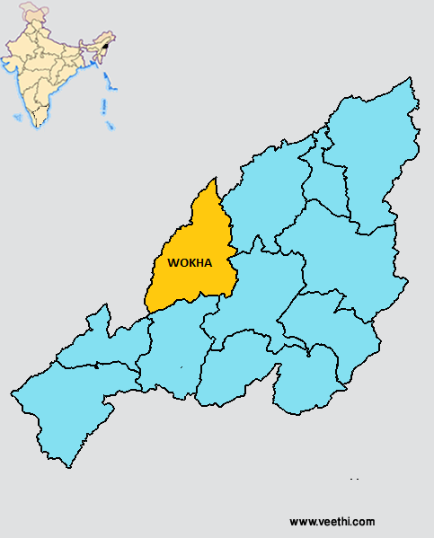
Boundaries of Wokha District
North: Mokokchung District, Nagaland
South: Kohima District, Nagaland
East: Zunheboto District, Nagaland
West: Assam
Wokha District Average Rainfall: 2000 mm
Wokha District Average Temperature in Summer: 27 deg C
Wokha District Average Temperature in Winter: 20 deg C
Average Relative Humidity: 85%
WOKHA DISTRICT MAP
Major Rivers: Doyang River, Chubi River, Nzhu River
Administrative Centers: Wokha, Bhandari, Ralan, Sanis, Merapani, Chukitong, Lotsu, Wozhuro, Changpang, Altepyong, Sungro, Baghty, Englan
Assembly Constituencies: Tyui, Wokha, Sanis, Bhandari
Peaks and Valleys: Mount Tiyi, Baghty Valley, Tehurang Valley, Doyang Valley
Lakes: Totsu Wozhu Lake, Sanis Lake, Mekokla Lake
Wokha District Nearby Attractions
1. Etsuchukha
2. Vankhosung
3. Doyang Hydro Project
4. Liphanyan Governor’s Camp
Wokha District Facts: It is one of the three backward districts in Nagaland that is receiving funds from the Backward Regions Grant Fund Program.
Major Agricultural Products: Paddy, maize, wheat, millets, fruits like oranges, plum, bananas
Major Industries: Weaving, poultry, carpentry, handicrafts, cane and bamboo works
What is Wokha District Famous For: Fruits
Last Updated : Thursday Jun 14 , 2012


