Date of Formation: Mahoba District was carved out of Hamirpur District on 11th February 1995.
Area: 3040 square kilometers
Density of population: 288 people per square kilometer
Literacy Rate: 66.94 % - Male: 77.72 %, Female: 54.65 %
Male Female Ratio: 1000:880
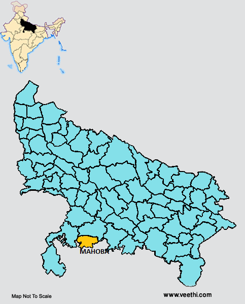
Boundaries of Mahoba District
North: Hamirpur District, Uttar Pradesh
West: Lalitpur District, Uttar Pradesh
East and South: Madhya Pradesh
Mahoba District Average Rainfall: 869.7 mm
Mahoba District Average Temperature in Summer: 33.75 deg C
Mahoba District Average Temperature in Winter: 15.92 deg C
MAHOBA DISTRICT MAP
Major Rivers: River Mandakini
Tehsils: Mahoba, Charkhari, Kulpahar
Blocks: Charkhari, Jaitpur, Kabrai, Panwari
Assembly Constituencies: Charkhari, Mahoba
Mahoba District Nearby Attractions
1. Shiv Tandav
2. Khakraha Math
3. Sun Temple
4. Jain Tirthkar
5. Urmil Dam
6. Belatal
7. Sri Nagar
8. Charkhari Estate
9. Betel Farm
10. Gokhar Parvat
11. Alha and Udal Chowk
12. Chandika Devi Temple
13. Vijay Sagar Pakshi Vihar Bird Sanctuary
14. Sita Sej
15. Patal Ganga
16. Bhairon Ki Jhariad
Mahoba District Facts: It is the least populous district of Uttar Pradesh. This is a part of Chitrakoot Division. This is one of the 34 most backward districts in Uttar Pradesh that is receiving funds from Backward Regions Grant Fund Program.
Major Agricultural Products: Wheat, barley, sorghum, pearl millet, maize, pulses, oilseeds
Major Industries: Dairy, poultry, fishery, animal husbandry
What is Mahoba District Famous For: Vijay Sagar Pakshi Vihar
Best Time To Visit: October to February
Famous People From Mahoba District: Udal Mahoba, Cecil Pullan, Dewan Shatrughan Singh, Kumari
Last Updated : Tuesday Jun 12 , 2012


