Date of Formation: 1st September 1970
Area: 2036 square kilometers*
Density of Population: 341 people per square kilometer*
Literacy Rate: 88.29 % - Male: 91.77 %, Female: 84.69 %
Male Female Ratio: 1000:967
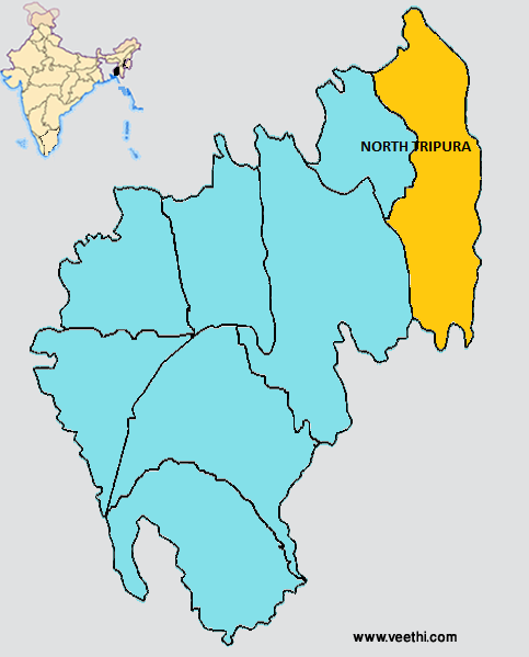
Boundaries of North Tripura District
North and South: Bangladesh
East: Mizoram
West: Dhalai District and Unakoti District, Tripura
North Tripura District Average Rainfall: 2859.2 mm
North Tripura District Average Temperature in Summer: 28.16 deg C
North Tripura District Average Temperature in Winter: 18.23 deg C
NORTH TRIPURA DISTRICT MAP
Major Rivers: Deo, Manu, Longai, Juri
Sub Divisions: Dharmanagar, Kanchanpur, Panisagar
Development Blocks: Kumarghat, Yuvarajnagar, Dashda, Jampui, Panisagar, Damchara
Municipals: Dharmanagar Nagar Panchayet
Assembly Constituencies: Jubarajnagar, Bagbassa, Panisagar, Pencharthal, Kanchanpur, Dharmanagar, Kurti
North Tripura District Nearby Attractions
1. Laxmi Narayan Temple
2. Jampui Hill
3. Bhagabati Mandir
4. Sateramia Hawar
5. Udayan Buddha Bihar of Pechartal
6. Purano Rajbari
7. Udayan Buddha Mandir
8. Bhabatarini Mandir
9. Rowa Wildlife Sanctuary
North Tripura District Facts: Six helipads were constructed in this district to serve the emergency or during the natural disasters like earthquake as Tripura falls under seismic zone V, the highest quake prone zone in the world.
Major Agricultural Products: Rice, cereals, jackfruits, banana
Major Industries: Food processing, brick kilns, plastics, polymers, spun pipes, wood works, natural rubber, distilleries, handloom, handicrafts
What is North Tripura District Famous For: Tea Gardens
North Tripura District Pin Codes
Last Updated : Sunday Jun 10 , 2012


