Date of formation: 28th May 1948
Area: 4459 square kilometers
Density of population: 382 people per square kilometer
Literacy Rate: 76.59 % - Male: 87.17 %, Female: 63.96 %
Male Female Ratio: 1000:838
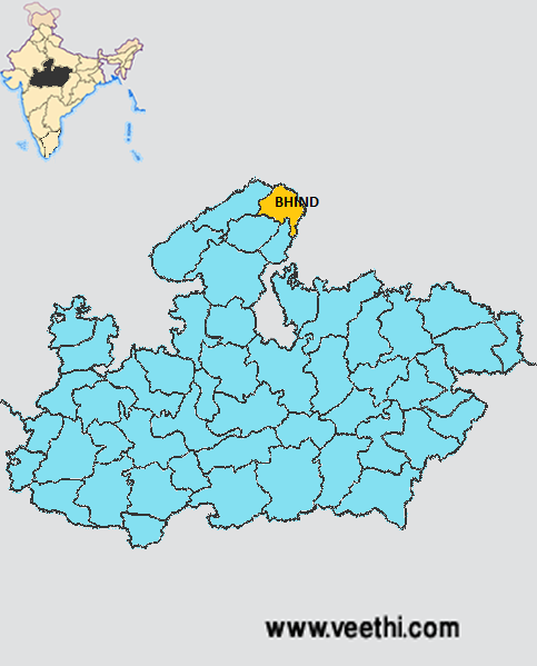
Boundaries of Bhind District
North and East: Agra District, Etawah District, Jalaun District and Jhansi District, Uttar Pradesh
South: Datia District, Madhya Pradesh
South West: Gwalior District, Madhya Pradesh
West: Morena District, Madhya Pradesh
Bhind District Average Rainfall: 697.7 mm
Bhind District Average Temperature in Summer: 34.28 deg C
Bhind District Average Temperature in Winter: 15.19 deg C
BHIND DISTRICT MAP
Major Rivers: Chambal, Kali Sind, Kunwari, Pahuj, Baisali
Tehsils: Bhind, Ater, Mehgaon, Gohad, Mihona, Lahar, Raun
Assembly Constituencies: Ater, Bhind, Gohad, Lahar, Mehgaon
Bhind District Nearby Attractions
1. Shri Rawatpur Dam
2. Chhatri of Malhar Rao Holkar at Alampur
3. Fort of Ater
4. Jain Temples
5. Mata Renuka Temple
6. Narad Dev Temple
7. National Chambal Wildlife Sanctuary
8. Gohad Fort
9. Sun Temple
10. Ancient Dadraua Temple
11. Malanpur
Bhind District Facts: This district was named after Bhindi Rishi.
Major Agricultural Products: Rice, bajra, millets
Major Industries: Animal husbandry, poultry farming, eggs, ghee
What is Bhind District Famous For: Chambal dacoits
Famous People From Bhind District: Ashok Argal, Bhim Singh Rana, Girdhar Pratap Singh, Kirat Singh, Ramlakhan Singh, Vibhandak Rishi, Chhatar Singh
Last Updated : Friday Jun 15 , 2012


.jpeg "Manmeet Singh (music Composer)")


