Date of Formation: 1979
Area: 949 square kilometers
Density of Population: 598 people per square kilometer
Literacy Rate: 65.00 % - Male: 75.41 %, Female: 53.81 %
Male Female Ratio: 1000:913
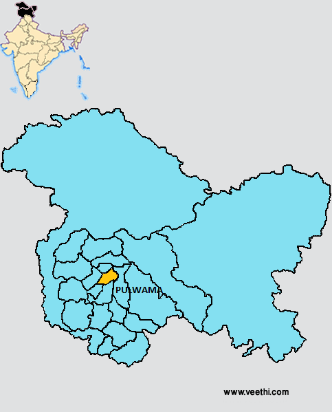
Boundaries of Pulwama District
North: Srinagar District, Jammu and Kashmir
South: Kulgam District and Shopian District, Jammu and Kashmir
East: Anantnag District, Jammu and Kashmir
West: Budgam District, Jammu and Kashmir
Pulwama District Average Rainfall: 809.0 mm
Pulwama District Average Temperature in Summer: 23.24 deg C
Pulwama District Average Temperature in Winter: 4.33 deg C
PULWAMA DISTRICT MAP
Tehsils: Pampore, Pulwama, Tral
Blocks: Kaka Pora, Pampore, Pulwama, Tral
Assembly Constituencies: Tral, Pampore, Pulwama, Raj Pora
Lakes: Kaunsernag Lake, Marsar Lake
Pulwama District Nearby Attractions
1. Aripal Nagh
2. Kungwattan
3. Aharbal Waterfalls
4. Tarsar and Marsar
5. Nagberan
6. Shikargah
7. Hurpora
8. The Avantishwar Temple
9. The Payer Temple
10. Asar Sharif Pinjoora
11. The Shrine of Shah Hamdan
12. Jama Masjid Shopian
13. The Shrine of Syed Hassan Mantaqui
Pulwama District Facts: Pulwama is called the Anand of Kashmir and Dudha Kul of Kashmir owing to its high milk production.
Major Agricultural Products: Rice, wheat, maize, vegetables, fruits, oil seeds, saffron, milk
Major Industries: Government Cement Factory, Joinery Mill, Brick and Tile Factory and food based, wood based and agro based industries
What is Pulwama District Famous For: Its milk production
Famous People From Pulwama District: Sheikh Abdullah, Ghulam Hassan Pinglana
Last Updated : Thursday Jun 14 , 2012


