Date of Formation: Doda District was carved out of Udhampur District in 1948.
Area: 5170 square kilometers
Density of Population: 79 people per square kilometer
Literacy Rate: 65.97 % - Male: 80.36 %, Female: 50.34 %
Male Female Ratio: 1000:922
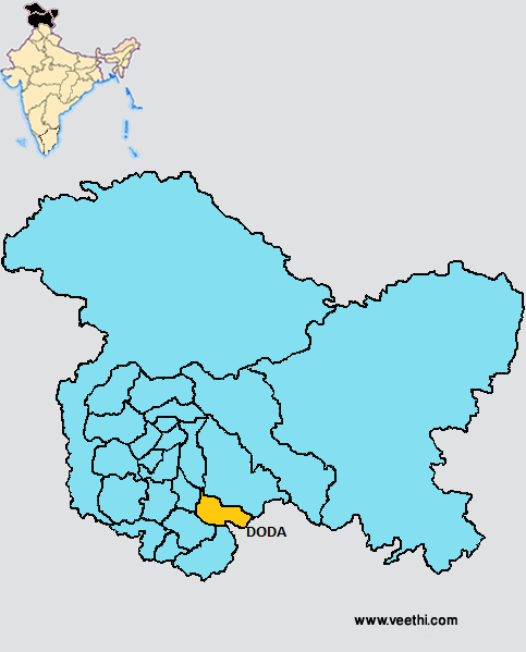
Boundaries of Doda District
North East: Kishtwar District, Jammu and Kashmir
North West: Anantnag District and Ramban District, Jammu and Kashmir
South West: Udhampur District, Jammu and Kashmir
South: Kathua District, Jammu and Kashmir
South East: Himachal Pradesh
Doda District Average Rainfall: 789.1 mm
Doda District Average Temperature in Summer: 23.91 deg C
Doda District Average Temperature in Winter: 4.84 deg C
DODA DISTRICT MAP
Major Rivers: Chenab River
Tehsils: Doda, Bhaderwah, Thatri, Gando
Blocks: Assar, Bhaderwah, Bhagwa, Beoli, Doda, Gundana, Matta, Thatri
Assembly Constituencies: Bhaderwah, Doda
Doda District Nearby Attractions
1. Kishtwar
2. Bhaderwah
3. Chinta Valley
4. Khani Top
5. Patnitop
6. Sanasar
7. Sarthal
8. Machail
9. Kailash Yatra
10. Gupt Ganga and Vasukinag
11. Reushra
Doda District Facts: In June 2006, this district was trifurcated into Doda District, Ramban District and Kishtwar District. It is one of the three most backward districts of Jammu and Kashmir that is receiving funds from the Backward Regions Grant Fund Program. NH 1A and NH 1B pass through this district.
Major Agricultural Products: Maize, wheat, paddy, pulses
Mineral Resources: Lead, mica, gypsum, manganese, marble, graphite, copper
Languages Spoken: Dogri, Bhadarwahi, Pogli, Paddri, Kishtwari, Siraji, Punjabi
What is Doda District Famous For: Snowfall in winter
Famous People From Doda District: Chuni Lal
Last Updated : Thursday Jun 14 , 2012


.jpeg "Gopi Krishna (yogi)")


