Area: 39,313 square kilometers
Density of population: 17 people per square kilometer
Literacy Rate: 58.04 % - Male: 73.09 %, Female: 40.23 %
Male Female Ratio: 1000:849
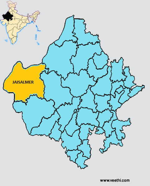
Boundaries of Jaisalmer District
North East: Bikaner District, Rajasthan
South: Barmer District, Rajasthan
East: Jodhpur District, Rajasthan
West and North: Pakistan
Jaisalmer District Average Rainfall: 201.05 mm
Jaisalmer District Average Temperature in Summer: 34.20 deg C
Jaisalmer District Average Temperature in Winter: 15.61 deg C
JAISALMER DISTRICT MAP
Tehsils: Jaisalmer, Pokhran, Mohangarh
Assembly Constituencies: Jaisalmer, Pokhran
Jaisalmer District Nearby Attractions
1. Patwa Havelis
2. Madir Palace
3. Gadsisar Lake
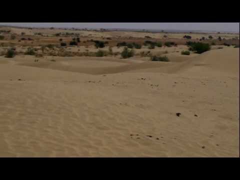
4. Thar Desert
5. Salim Singh Haveli
6. Nathmal’s Haveli
7. Government Museum and the Folk Museum
8. Jaisalmer Fort
Jaisalmer District Facts: This is the least populous district of Rajasthan. Due to its yellow sand, the city is known as the Golden City of India. It is one of the 12 most backward districts in Rajasthan that is receiving funds from the Backward Regions Grant Fund Program.
Major Agricultural Products: Jowar, guar seed, wheat, mustard, groundnut, gram, rapeseed, motif, til, barley
Major Industries: Tourism, stone cutting, carving, khadi industry, mineral based industry
Major Educational Institutions: SBK Government Post Graduate College, Vardhaman Mahaveer Open University, Government Girls College, Chandrawati Engineering College, Maa Durga Sansthan Teacher Training College
What is Jaisalmer District Famous For: Leather messenger bags made from camel skin
Famous People From Jaisalmer District: Sagarmal Gopa, Sona Ram, Rajyavadhan Singh Rathore, Rawal Jaisal
Last Updated : Sunday Jun 10 , 2012