Date of formation: Baran District was carved out of Kota District on 10th April 1991.
Area: 6996 square kilometers
Density of population: 175 people per square kilometer
Literacy Rate: 67.38 % - Male: 81.23 %, Female: 52.48 %
Male Female Ratio: 1000:926
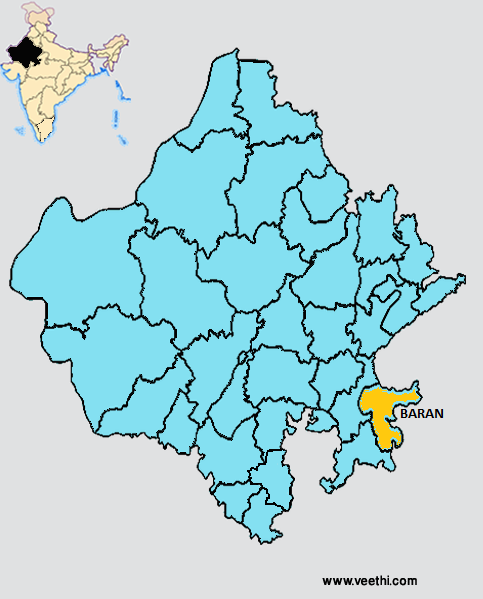
Boundaries of Baran District
North and East: Madhya Pradesh
South and South West: Jhalawar District, Rajasthan
North West and West: Kota District, Rajasthan
Baran District Average Rainfall: 954.7 mm
Baran District Average Temperature in Summer: 34.66 deg C
Baran District Average Temperature in Winter: 17.41 deg C
BARAN DISTRICT MAP
Major Rivers: Kali Sindh, Parvati, Parwan, Niwaj, Ahu River
Sub Divisions: Baran, Shahabad, Atru
Tehsils: Antah, Atru, Baran, Chhabra, Chhipabarod, Kishanganj, Mangrol, Shahabad
Assembly Constituencies: Anta, Kishanganj, Baran, Atru, Chhabra
Baran District Nearby Attractions
1. Shahabad Fort
2. Sita Baadi
3. Sher Garh Fort
4. Nahar Garh Fort
5. Bhanwar Garh Fort
6. Kanya Dah Bilas Garh
7. Bhand Devara
8. Ramgarh Mata Ji
9. Kapil Dhara
10. Soursan
11.Kakoni
Baran District Facts: NH 76 passes through this district.
Major Agricultural Products: Soyabean, maize, paddy, wheat, coriander, gram, guava, mango
Major Industrial Products: Chemical, iron and steel, electric products, textiles, forest, paper, rubber, plastics
Major Educational Institutions: Government P.G. College, Government Girls College, Kendriya Vidyalaya, Government Secondary School
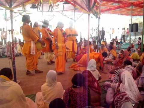
Fairs and Festivals: Dolmela, Sitabari Mela, Brahmani Mataji Mela, Piplod Christmas Fair, Phuldol Folk Festival, Urs – Balakhera
What is Baran District Famous For: Exclusive quality Tericot-Khadi
Best Time To Visit: September to November
Last Updated : Friday Jun 15 , 2012


.jpeg "Bhanwari Devi (1992 Case)")


