Area: 5036 square kilometers
Density of population: 242 people per square kilometer
Literacy Rate: 64.95 % - Male: 76.41 %, Female: 52.26 %
Male Female Ratio: 1000:905
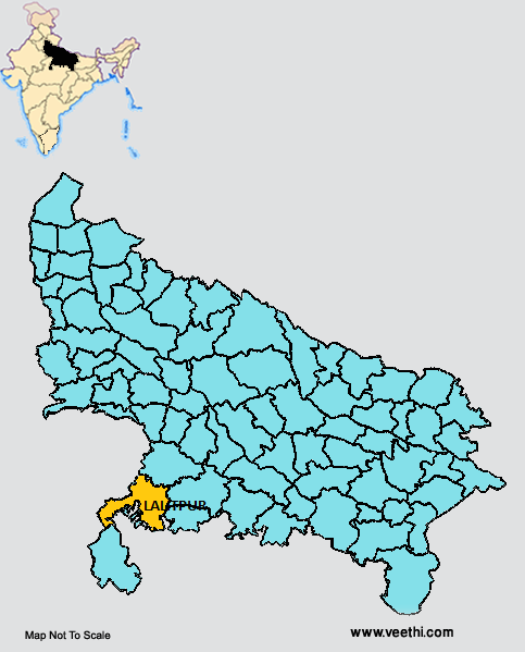
Boundaries of Lalitpur District
North West, West and South East: Madhya Pradesh
South West: Lalitpur District, Uttar Pradesh
North East: Jalaun District, Uttar Pradesh
East: Hamirpur District and Mahoba District, Uttar Pradesh
Lalitpur District Average Rainfall: 919.9 mm
Lalitpur District Average Temperature in Summer: 33.98 deg C
Lalitpur District Average Temperature in Winter: 17.24 deg C
LALITPUR DISTRICT MAP
Major Rivers: Betwa River, Dhasan River, Jamni River
Tehsils: Lalitpur, Mahroni, Talbehat
Blocks: Bar, Birdha, Jakhora, Madawra, Mahroni, Talbehat
Assembly Constituencies: Lalitpur, Mahroni (SC)
Dams: Matatila Dam, Govind Sagar Dam, Jamni Dam, Rajghat Dam, Sajanm Dam, Sehjad Dam, Rohini Dam
Lalitpur District Nearby Attractions
1. Devgarh
2. Seeronji
3. Pawagiriji
4. Sadashah Ki Majaar
5. Muchkund Ki Gufayen
6. Devmata
7. Kshetrapalji
8. Tuvan Mandir
9. Boodhe Babba
Lalitpur District Facts: Govind Sagar Dam here is one of the three dams in India that works on siphon system. This turns on when the water reaches a particular level. It is the one of the 34 most backward district of Uttar Pradesh that is receiving funds from the Backward Regions Grant Fund Program.
Major Agricultural Products: Rice, soybean, wheat, oilseeds, maize, pulses, barley, jowar
Major Industries: Stone idols, brass industries, handloom industries
What is Lalitpur District Famous For: Its Dams
Famous People From Lalitpur District: Purushottam Das Tandon
Last Updated : Tuesday Jun 12 , 2012


