Area: 7685 square kilometers
Density of population: 504 people per square kilometer
Literacy Rate: 82.90 % - Male: 91.33 %, Female: 74.18 %
Male Female Ratio: 1000:953
Boundaries of Kolhapur District
North: Warana River
South: Belgaum District, Karnataka
East: Krishna River
West: Sahyadri Ranges
Kolhapur District Climate: The climate is temperate and the hot season lasts from March to May, rainy season from June to October and the winter season from November to February. The different places receive different amounts of rainfall ranging from 500 mm to 5000 mm.
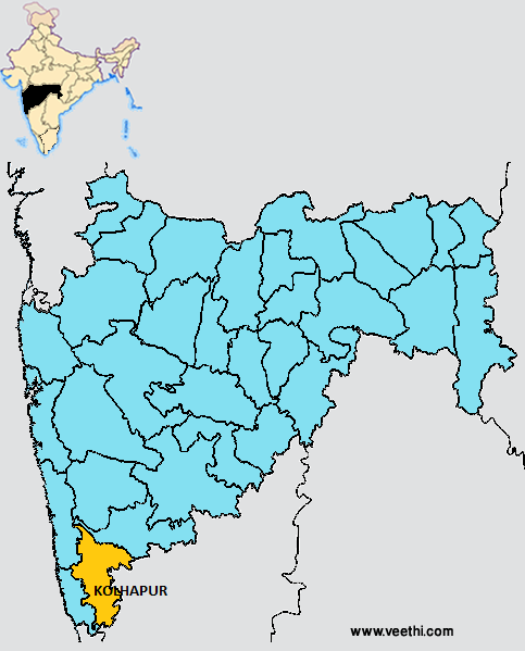
KOLHAPUR DISTRICT MAP
Major Rivers: Tillari River, Panchganga, Krishna
Taluks: Kagal, Karvir, Bhudargad, Panhala, Gadhinglaj, Shirol, Hatkanangale, Ajra, Chandgad, Gaganbawada, Radhanagari, Shahuwadi
Assembly Constituencies: Chandgad, Hatkanangle, Ichalkaranji, Kagal, Karvir, Kolhapur North, Kolhapur South, Radhanagari, Shahuwadi, Shirol
Kolhapur District Nearby Attractions
1. Shringeri
2. Samangad
3. Jyotiba Temple
4. Khidrapur
5. Chitri Dam
6. Ravalnath Mandir
7. Lady of Rosary Church
8. Maharaja Palace
9. Shahuji Chhatrapati Museum
10. Rankala Lake
Kolhapur District Facts: The per capita income of this district is the highest in Maharashtra. This is also called Dakshin Kashi. Gaganbawada region receives 5000 mm of rainfall and is called the Chirapunji of Maharashtra.
Major Agricultural Products: Rice, jowar, ragi, groundnut, soybean, oil seeds, sugarcane, cotton, jiggery, millets, betel leaves
Major Industrial Products: Sugar, jaggery
What is Kolhapur District Famous For: Chappals, Jaggery, Milk Exports
Famous People From Kolhapur District: Sankaracharya, P. L. Deshapande, Ranjit Desai
Last Updated : Friday Jun 15 , 2012