Date of Formation: 25th May 1983
Area: 2110 square kilometers
Density of Population: 622 people per square kilometer
Literacy Rate: 57.68 % - Male: 69.56 %, Female: 44.90 %
Male Female Ratio: 1000:933
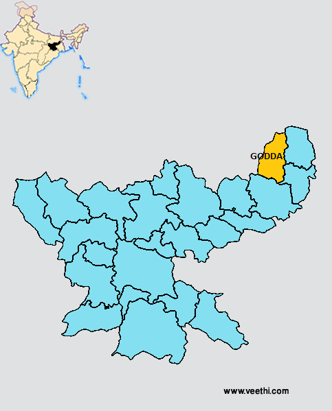
Boundaries of Godda District
North and West: Bihar
South: Dumka District, Jharkhand
East: Sahibganj District and Pakur District, Jharkhand
Godda District Average Rainfall: 991.2 mm
Godda District Average Temperature in Summer: 30.93 deg C
Godda District Average Temperature in Winter: 17.13 deg C
GODDA DISTRICT MAP
Major Rivers: Khajhia, Sunder, Sakri
Blocks: Bansjori, Pathargama, Pareya Hat, Sankarpur, Thakurgangti, Godda, Mahagama, Meharama
Assembly Constituencies: Mahagama, Borma, Godda, Bhatondha, Pareya Hat
Godda District Nearby Attractions
1. Madhupur
2. Godda
3. Dhuraiya
4. Jarmundi
5. Poreyahat
6. Chakai
Godda District Facts: The coalfields of ECL is one of the biggest in Asia. This is one of the 21 most backward districts of Jharkhand that is receiving funds from the Backward Regions Grant Fund Program.
Major Agricultural Products: Wheat, paddy, maize, linseed, khesari, vegetables, ragi
Major Industries: Hume pipe manufacturing, saw mills, flour mills, oil mills, soap factory, stone crusher, silk and cotton weaving
Flora: Sal, mahua, semal, sisam, kathal
What is Godda District Famous For: Rajmahal coalfields in Lalmatia
Last Updated : Monday Jun 11 , 2012
.jpeg "Krishna Bharadwaj (actor)")


.jpeg "Subhash Mukhopadhyay (physician)")
