Date of Formation: Deoghar District was formed on 1st June 1986 from Santhal Parganas District.
Area: 2479 square kilometers
Density of population: 602 people per square kilometer
Literacy Rate: 66.34 % - Male: 79.13 %, Female: 52.39 %
Male Female Ratio: 1000:921
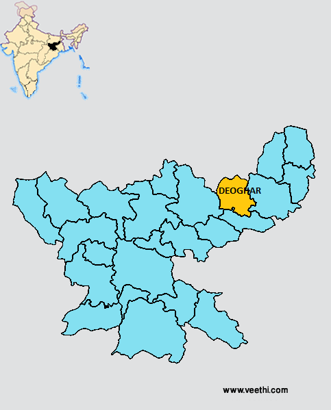
Boundaries of Deoghar District
North: Bihar
South: Jamtara District, Jharkhand
East: Dumka District, Jharkhand
West: Giridih District, Jharkhand
Deoghar District Average Rainfall: 1056.5 mm
Deoghar District Average Temperature in Summer: 31.94 deg C
Deoghar District Average Temperature in Winter: 17.57 deg C
DEOGHAR DISTRICT MAP
Major Rivers: Ajay, Paltro
Blocks: Deoghar, Karo, Madhupur, Mohanpur, Palojori, Sarath, Sarwa
Assembly Constituencies: Deoghar, Jasidih, Madhupur, Sarath
Deoghar District Nearby Attractions
1. Bakulia
2. Burhai
3. Domohani
4. Karo
5. Deoghar
6. Pathrol Kali Mandir
7. Taapovan
8. Naulakha Temple
Deoghar District Facts: NH 6 passes through this district. This is one of the 21 most backward districts of Jharkhand that is receiving funds from the Backward Regions Grant Fund Program.
Major Agricultural Products: Paddy, millets, pulses, oil seeds, fibre, condiments, sugarcane
Major Educational Institutions: Saint Francis School, Ramakrishna Mission Vidyapith, G.D.D.A.V. School, Modern Public School, Saint Francis School
What is Deoghar District Famous For: Baidyanath Jyotirling Shrine
Famous People From Deoghar District: Kishore Kumar Malviya, Muchkund Dubey, Ram Rudra Prasad Deo
Last Updated : Tuesday Jun 12 , 2012


.jpeg "Krishna Bharadwaj (actor)")


