Date of Formation: Mewat District was carved out of Gurgaon District and Faridabad District on 4th April 2005.
Area: 1499 square kilometers
Density of Population: 729 people per square kilometer
Literacy Rate: 56.10 % - Male: 73.00 %, Female: 37.60 %
Male Female Ratio: 1000:906
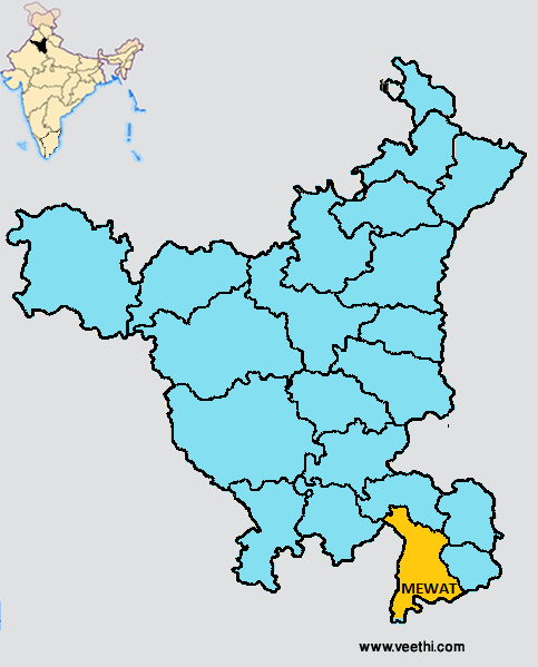
Boundaries of Mewat District
North: Gurgaon District, Haryana
South: Alwar District and Bharatpur District, Rajasthan
East: Palwal District, Haryana
West: Rewari District, Haryana
Mewat District Average Rainfall: 400 mm
Mewat District Maximum Temperature in Summer: 48 deg C
Mewat District Minimum Temperature in Winter: 4 deg C
MEWAT DISTRICT MAP
Tehsils: Nuh, Firozpur Jhirka, Punahana, Taoru
Blocks: Ferozepur Jhirka, Nagina, Nuh, Punahana, Taoru
Assembly Constituencies: Nuh, Firozpur Jhirka, Punahana
Mewat District Facts: NH 71 B and NH 8 pass through this district. The people of Mewat are called Meos.
Major Agricultural Products: Barley, wheat, cotton, sunflower, water melon, tomato, olive, grapes
Major Educational Institutions: Saraswati Vidya Mandir College of Educcation, Chandravati College of Education, Rao Adal Singh College of Education, SD Mewat Institute of Technology and Management, Sehrawat Degree College of Education, Shri Shanti Sagar Jain Girl’s College of Education
What is Mewat District Famous For: Mewati Gharana
Famous People From Mewat District: Mohammad Zainuddin, Qazi Ghulam Mustafa, qazi Syed Inayatullah, Qazi Syed Hayatullah, Qazi Mir Imdad Ali, Syed Mohammad Ashraf, Qazi Syed Mohammad Rafi
Last Updated : Saturday Jun 9 , 2012


.jpeg "Manmohan Singh (film Director)")


