Date of formation: Khagaria District was created on 10th May 1981.
Area: 1486 square kilometers
Density of population: 1115 people per square kilometer
Literacy Rate: 60.87 % - Male: 68.51 %, Female: 52.16 %
Male Female Ratio: 1000:883
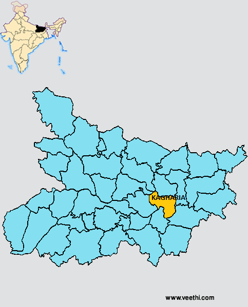
Boundaries of Khagaria District
North: Saharsa District, Samastipur District, Darbhanga District, Bihar
South East: Bhagalpur District, Bihar
South West: Munger District, Bihar
West: Begusarai District, Bihar
East: Madhepura District, Bihar
Khagaria District Average Rainfall: 913.09 mm
Khagaria District Average Temperature in Summer: 30.73 deg C
Khagaria District Average Temperature in Winter: 16.69 deg C
KHAGARIA DISTRICT MAP
Major Rivers: Ganga River, Kosi River, Burhi Gandak, Bagmati, Kareh, Kamla
Sub Divisions: Khagaria, Ghoghri
Blocks: Gogari, Parwatta, Khagaria, Alauli, Chautham, Beldaur, Mansi
Assembly Constituencies: Alauli, Khagaria, Beldaur, Parbatta
Khagaria District Nearby Attractions
1. Katyayani Asthan
Khagaria District Facts: It is one of the 36 most backward districts in Bihar and is receiving funds from the Backward Regions Grant Fund Program. NH 31 and NH 107 pass through this district.
Major Agricultural Products: Paddy, wheat, maize, jute, oil seeds, vegetables, banana
Major Industries: Horticultural industries, agro-based industries, dairy
What is Khagaria District Famous For: Ghee making
Last Updated : Thursday Jun 14 , 2012


