Date of formation: Tawang District was carved out of West Kameng District in 1989.
Area: 2,172 square kilometers
Density of population: 23 people per square kilometer
Literacy Rate: 60.61 % - Male: 68.54 %, Female: 48.75 %
Male Female Ratio: 1000:701
Boundaries of Tawang District
North: Tibet
South: West Kameng District, Arunachal Pradesh, Bhutan
West: Bhutan
East: West Kameng District, Arunachal Pradesh
Tawang District Climate: This district gets heavy snowfall. January and February are the driest months. The temperature drops below freezing point in winter.
Tawang District Average Annual Rainfall: 1600 mm
TAWANG DISTRICT MAP

Major Rivers: Tawang River, Tawangchu, Nyamyanjchu
Sub Divisions: Tawang, Lumla, Jang
Circles: Tawang, Kitpi, Bongkhar, Dudunghar, Lumla, Zemithang, Jang, Mukto, Thingbu, Lhou
Assembly Constituencies: Lumba, Tawang, Mukto
Lakes: Pangang Teng Tso Lake, Shonga-tser Lake, Banga Zang Lake
Peaks: Gorichen Peak, Ghesila Range
Tawang District Nearby Attractions
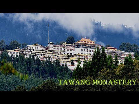
1. Tawang Monastery
2. Pankang Teng Tso Lake
3. Sela Top Pass
Tawang District Facts: This is the eighth least populous district in India. Indian military is stationed here due to cross border tensions. Dalai Lama visited this place in November 2009.
Major Agricultural Products: Ginger, turmeric, chillies, sugarcane, wheat, maize, millet
Major Horticulture Products: Apple, walnut, kiwi, citrus, pineapple, banana
Major Industries: Yak breeding and sheep breeding
People: Monpa, Takpa, Tibetans, Botia, Adi
Festivals: Losar, Choskar, Torgya, Dungyur
Best Time to Visit: April to October
Last Updated : Thursday Jun 14 , 2012