Date of Formation: Andaman District was bifurcated on 18th August 2006 and North and Middle Andaman District was created out of it.
Area: 3252 square kilometers
Density of Population: 32 people per square kilometer
Literacy Rate: 84.25 % - Male: 88.72 %, Female: 79.39 %
Male Female Ratio: 1000:925
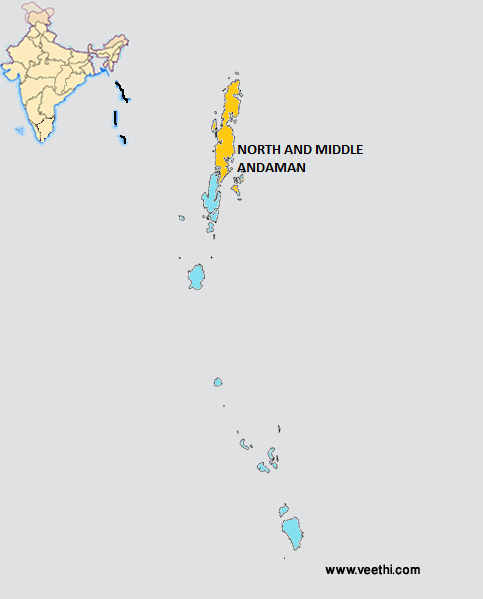
Location of North and Middle Andaman District
It is located in the Bay of Bengal Ocean southeast of India and to the north side of the South Andaman District. The North and Middle Andaman District is separated from South Andaman District by a narrow canal.
North and Middle Andaman District Average Rainfall: 2867 mm
North and Middle Andaman District Average Temperature in Summer: 29 deg C
North and Middle Andaman District Average Temperature in Winter: 22 deg C
NORTH AND MIDDLE ANDAMAN DISTRICT MAP
Towns: Rangat, Billiground, Kadamtala, Bakultata, Betapur
Blocks: Diglipur, Mayabunder, Rangat
North and Middle Andaman District Nearby Attractions
1. Karamatang Beach
2. Mangrove lined creeks
3. Avis Island Beach
North and Middle Andaman District Facts: The main occupation of people is agriculture. Bengali, Tamil and Keralite settlers form the majority of population. Mayabunder is the biggest city here and it is connected with Portblair by Andaman Trunk Road. The road distance is 242 kilometers and the sea distance is 136 kilometers. Mahatma Gandhi Government College is located here.
North and Middle Andaman District Pin Codes
Last Updated : Thursday Jun 14 , 2012


